
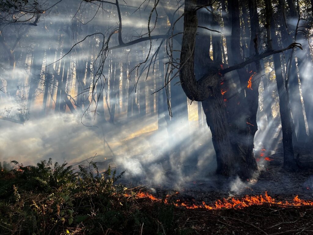
BODEGA BAY NEWS | SONOMA COUNTY COAST — October 18, 2026. Visitors traveling north along the Sonoma Coast should prepare for possible smoke and a temporary trail closure at Salt Point State Park. California State Parks announced October 16 that a controlled burn is tentatively scheduled for Monday, October 19, through Wednesday, October 21, near Seaview Road.
The agency says Prairie Trail will be temporarily closed during burn operations and directs visitors to avoid the affected area. This is a planned prescribed burn, not a report that an uncontrolled wildfire is burning at Salt Point. Ignition depends on weather, fuel moisture and air conditions, so the schedule may shift.
What is planned at Salt Point?
In its October 7 news release, State Parks described a project covering up to 261 acres of coastal forest near Seaview Road. Officials said burns would be undertaken across several days, when conditions allow, to reduce accumulated fuels, improve habitat and support long-term stewardship of native vegetation.
“Up to 261 acres” describes the project’s potential treatment area, not acreage already burned. The October 16 update specifies the next tentative window and the Prairie Trail restriction; neither announcement confirms that an ignition has occurred.
Is Salt Point State Park closing?
State Parks said the park would remain open during its planned prescribed-fire operations, while Prairie Trail would be temporarily unavailable. Other areas could be affected by temporary signs or staff instructions as conditions change. Visitors should never bypass tape, barriers or closures on the assumption that the entire park remains unrestricted.
For travelers from Bodega Bay, Jenner, Sea Ranch or nearby communities, the practical issue is not just whether smoke is visible. It is whether a planned hike crosses a controlled-burn work area or whether coastal road and weather conditions affect travel.
Will there be smoke?
The October 7 statement notes that some smoke may be visible and that operations are coordinated with the Northern Sonoma County Air Pollution Control District to reduce impacts when possible. Prescribed fire can still affect people sensitive to smoke. State Parks asks visitors to reduce exposure and follow any instructions from personnel on site.
Check AirNow for general air-quality information, bearing in mind that a regional reading may not capture every nearby smoke plume. If you encounter an unidentified fire or immediate threat, emergency services remain the appropriate response. A planned ignition elsewhere is not a reason to disregard genuine danger.
Where to verify changes
- State Parks’ October 16 scheduled-burn update.
- October 7 release with treatment scale and smoke information.
- Salt Point State Park — official information and current advisories.
What changes for residents and visitors? The most immediate effects are a possible short-term smoke episode and Prairie Trail access restrictions, not a confirmed emergency evacuation or a full-park closure. Confirm the operational status on the day of travel.
Bodega Bay News is a California58 local edition. Reporting is based on California State Parks announcements of October 7 and October 16, 2026. No active ignition, completed acreage or real-time trail condition is independently asserted.
Support Bodega Bay News
Choose how to support Bodega Bay News:
Credit / Debit Card via StripeChoose an amount from $1. One-time support through the publisher's LINKERNO Stripe account.
Continue with PayPalZelle323-677-7643Open Zelle through your bank. Verify the recipient before sending.
Optional reader support. When possible, add “Bodega Bay News” to the payment note. Contributions are not advertised as tax-deductible. Support does not influence editorial decisions.More from Bodega Bay News
- Bodega Bay News: PG&E Proposes Removing 70 Aging Cypress Trees at Marine Reserve →
- Bodega Bay News: $3.05 Million State Grant Advances Protection of Osprey Hill Ranch Near Bodega Bay →
COMMUNITY
Comments
Join the California58 conversation. You must be signed in to comment.
Create a free California58 account or sign in with an available social provider.