
Explore all 21 historic Alta California missions in one California58 Travel guide. This independent directory links the missions’ historical context with modern visitor information. The chain began in San Diego in 1769 and ended at Sonoma in 1823. The missions were institutions of Spanish and later Mexican colonization; their legacy must be understood alongside the voices, losses, survival and continuing communities of California Native peoples.
Reading in Russian? Полный путеводитель по всем 21 миссиям Калифорнии на RusCali.com →. The Russian-language edition includes 21 individual reports and its own statewide travel map.
See all 21 California Missions on one map
Open the interactive mission map — 21 locations, directions, region filters and full-screen view →
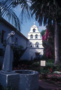
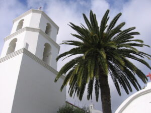
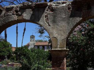
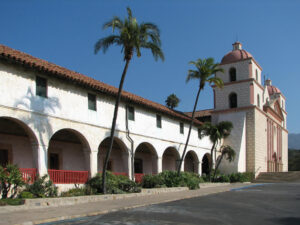
Explore the Missions Through Historic Site Photography
These are photographs of the actual sites, not AI-generated illustrations. Each image has a source and reuse credit. Many buildings were rebuilt or restored; photos show their appearance at the time of photography, not their 18th-century form.
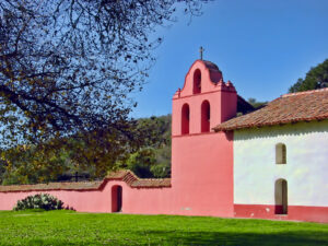
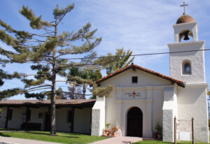
All 21 missions: explore each profile
Browse all California Missions articles in the dedicated category · Subscribe to California Missions updates via RSS.
- San Diego de Alcalá — 1769, San Diego (San Diego County). Historic site profile
- San Carlos Borromeo de Carmelo — 1770, Carmel-by-the-Sea (Monterey County). Historic site profile
- San Antonio de Padua — 1771, Jolon (Monterey County). Historic site profile
- San Gabriel Arcángel — 1771, San Gabriel (Los Angeles County). Historic site profile
- San Luis Obispo de Tolosa — 1772, San Luis Obispo (San Luis Obispo County). Historic site profile
- San Francisco de Asís (Mission Dolores) — 1776, San Francisco (San Francisco County). Historic site profile
- San Juan Capistrano — 1776, San Juan Capistrano (Orange County). Historic site profile
- Santa Clara de Asís — 1777, Santa Clara (Santa Clara County). Historic site profile
- San Buenaventura — 1782, Ventura (Ventura County). Historic site profile
- Santa Bárbara — 1786, Santa Barbara (Santa Barbara County). Historic site profile
- La Purísima Concepción — 1787, Lompoc (Santa Barbara County). Historic site profile
- Santa Cruz — 1791, Santa Cruz (Santa Cruz County). Historic site profile
- Nuestra Señora de la Soledad — 1791, Soledad (Monterey County). Historic site profile
- San José — 1797, Fremont (Alameda County). Historic site profile
- San Juan Bautista — 1797, San Juan Bautista (San Benito County). Historic site profile
- San Miguel Arcángel — 1797, San Miguel (San Luis Obispo County). Historic site profile
- San Fernando Rey de España — 1797, Mission Hills, Los Angeles (Los Angeles County). Historic site profile
- San Luis Rey de Francia — 1798, Oceanside (San Diego County). Historic site profile
- Santa Inés — 1804, Solvang (Santa Barbara County). Historic site profile
- San Rafael Arcángel — 1817, San Rafael (Marin County). Historic site profile
- San Francisco Solano — 1823, Sonoma (Sonoma County). Historic site profile
Open a mission road-trip route in Google Maps
Use these regional route links to view the missions on a navigable, full-screen map. Routes are suggestions, not a claim to reproduce the precise historical El Camino Real. Google Maps may adjust stop order and available waypoints on mobile. Review road conditions and opening days first.
- Southern California I · San Diego → San Gabriel — open route and map ↗
- Southern California II · San Gabriel → Santa Barbara — open route and map ↗
- Central Coast I · Santa Barbara → San Miguel — open route and map ↗
- Central Coast II · San Miguel → Carmel — open route and map ↗
- Monterey Bay and East Bay · Carmel → Santa Clara — open route and map ↗
- Northern California · Santa Clara → Sonoma — open route and map ↗
How to explore the trail
Southern California: 4–6 mission stops
Start with San Diego de Alcalá and San Luis Rey in San Diego County, continue into Orange County for San Juan Capistrano, then reach San Gabriel and San Fernando in the Los Angeles area. Allow time for museum visits and local Indigenous history exhibits; traffic makes distances deceptive.
Central Coast: Ventura to Carmel
A longer coastal itinerary links San Buenaventura, Santa Bárbara, Santa Inés, La Purísima near Lompoc, San Luis Obispo, San Miguel, San Antonio de Padua, Soledad and Carmel. San Antonio is remote; check official access before leaving U.S. 101.
Bay Area and Wine Country
Explore Santa Cruz and San Juan Bautista before continuing to Santa Clara, San José in Fremont, San Francisco’s Mission Dolores, San Rafael and the final mission in Sonoma. Several buildings are reconstructions, while others are active parish churches or museum-managed state historic parks.
Before you go
- Mission churches, state historic parks and university campuses follow different calendars; hours and admission are not uniform.
- Use the address and official visitor link on each profile rather than relying on a generic El Camino Real route marker.
- Respect active worship, cemeteries and Indigenous cultural sites. Ask before photographing ceremonies.
- No single present-day highway follows the entire historic El Camino Real exactly. Do not confuse a tourist driving route with an original Indigenous trail or mission-era road.
- Check accessibility and closures directly with the operator on the day of your visit.
Historical context and sources
California State Parks: Missions of the Californias · California Missions Foundation: 21 mission profiles · California State Parks: California Indian cultural heritage · California Missions Trail.
Support local historical journalism: California58’s guides and archival reporting are reader-supported. Support California58 independent journalism.